


Arrowhead Gun Club Voting District, Lunenburg County, Virginia
About
Outline

Summary
| Unique Area Identifier | 682117 |
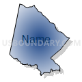
| Name | Arrowhead Gun Club Voting District |
| County | Lunenburg County |
| State | Virginia |
| Area (square miles) | 39.64 |
| Land Area (square miles) | 39.54 |
| Water Area (square miles) | 0.10 |
| % of Land Area | 99.75 |
| % of Water Area | 0.25 |
| Latitude of the Internal Point | 36.90950030 |
| Longtitude of the Internal Point | -78.43171010 |
Maps


Graphs
Select a template below for downloading or customizing gragh for Arrowhead Gun Club Voting District, Lunenburg County, Virginia


Neighbors
Neighoring Voting District (by Name) Neighboring Voting District on the Map
- Chase City Elementary School Voting District, Mecklenburg County, VA
- Drakes Branch Voting District, Charlotte County, VA
- Keysville Voting District, Charlotte County, VA
- Pleasant Grove Voting District, Lunenburg County, VA
- Reedy Creek Voting District, Lunenburg County, VA
- Saxe Voting District, Charlotte County, VA
- Sunshine Voting District, Mecklenburg County, VA
Top 10 Neighboring County Subdivision (by Population) Neighboring County Subdivision on the Map
- District 8, Mecklenburg County, VA (3,725)
- District 7, Mecklenburg County, VA (3,000)
- Walton district, Charlotte County, VA (2,781)
- Bacon district, Charlotte County, VA (2,626)
- Rehoboth district, Lunenburg County, VA (1,817)
- Central district, Charlotte County, VA (1,733)
- Loves Mill district, Lunenburg County, VA (1,496)
Top 10 Neighboring Unified School District (by Population) Neighboring Unified School District on the Map
- Mecklenburg County Public Schools, VA (32,727)
- Lunenburg County Public Schools, VA (12,914)
- Charlotte County Public Schools, VA (12,586)
Top 10 Neighboring State Legislative District Lower Chamber (by Population) Neighboring State Legislative District Lower Chamber on the Map
Top 10 Neighboring State Legislative District Upper Chamber (by Population) Neighboring State Legislative District Upper Chamber on the Map
Top 10 Neighboring 111th Congressional District (by Population) Neighboring 111th Congressional District on the Map
Top 10 Neighboring Census Tract (by Population) Neighboring Census Tract on the Map
- Census Tract 9301, Charlotte County, VA (6,032)
- Census Tract 9304, Mecklenburg County, VA (5,562)
- Census Tract 9302, Lunenburg County, VA (4,583)
- Census Tract 9303, Charlotte County, VA (3,666)